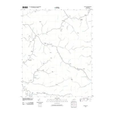
2010 Map of Ivyton
USGS Topo · Published 2010About this map
Middle Creek Levisa Fork serves as a primary drainage corridor through this eastern Kentucky landscape, anchoring a series of small, dispersed settlements like Brainard and Gypsy. The area is notably dense with family burial grounds, such as the Boone Howard Cemetery and Hackworth and Spradling Cemetery, which suggest long-standing generational ties to specific hollows and ridges. These cemeteries are often tucked away near junctions like Ivyton or along the winding paths of the Burning Fork.
Find a feature on this map
114 named features on this map. Tap any name to fly to it.
Don’t see what you’re looking for? This feature index may not catch every label — zoom into the map to look around manually.
Map Details
Editions of this 2010 Ivyton Map
This is the sole edition of this map. No revisions or reprints were ever made.
Other maps of this area

1886 · Prestonsburg
USGS Topo · 1:125,000

1889 · Salyersville
USGS Topo · 1:125,000

1891 · Salyersville
USGS Topo · 1:125,000

1892 · Prestonsburg
USGS Topo · 1:125,000

1899 · Salyersville
USGS Topo · 1:125,000

1915 · Paintsville
USGS Topo · 1:48,000

1915 · Prestonsburg
USGS Topo · 1:62,500

1917 · Paintsville
USGS Topo · 1:62,500

1918 · Prestonsburg
USGS Topo · 1:62,500

1951 · Tiptop
USGS Topo · 1:24,000