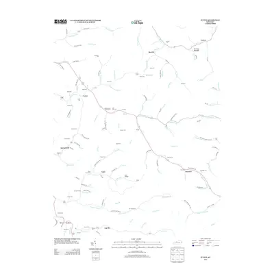
2013 Map of Ivyton
USGS Topo · Published 2013About this map
Middle Cr Levisa Fork and the Licking River define the intricate drainage patterns of this eastern Kentucky landscape, where small settlements follow the winding paths of creek valleys. Families and local historians will find an exceptional density of family burying grounds, including the Hackworth Cem, Bob Prater Cem, and Salyers Cem, which anchor the small communities of Brainard and Ivyton. The topography is marked by named hollows and forks such as Coon Hollow and State Road Fork, illustrating the traditional Appalachian settlement pattern where roads like Trojan Powder Rd and Meredith Branch Rd navigate the narrow corridors between steep ridges. These geographic ties between water, road, and family land preserved in locations like Swamp Branch and Galdia offer a detailed look at the local geography in the early twenty-first century.
Find a feature on this map
124 named features on this map. Tap any name to fly to it.
Don’t see what you’re looking for? This feature index may not catch every label — zoom into the map to look around manually.
Map Details
Editions of this 2013 Ivyton Map
This is the sole edition of this map. No revisions or reprints were ever made.
Other maps of this area

1886 · Prestonsburg
USGS Topo · 1:125,000

1889 · Salyersville
USGS Topo · 1:125,000

1891 · Salyersville
USGS Topo · 1:125,000

1892 · Prestonsburg
USGS Topo · 1:125,000

1899 · Salyersville
USGS Topo · 1:125,000

1915 · Paintsville
USGS Topo · 1:48,000

1915 · Prestonsburg
USGS Topo · 1:62,500

1917 · Paintsville
USGS Topo · 1:62,500

1918 · Prestonsburg
USGS Topo · 1:62,500

1951 · Tiptop
USGS Topo · 1:24,000