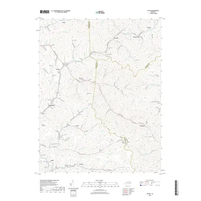
2019 Map of Ivyton
USGS Topo · Published 2019About this map
The Dawkins Line Rail Trail winds through the narrow valleys of this corner of Eastern Kentucky, tracing the path of a former rail corridor that once served the region's coal and timber industries. This 2019 survey documents the intricate network of family cemeteries that define the local genealogy, including the Patrick Cem, Hackworth Cem, and Boone Howard Cem. Small settlements like Ivyton, Marshallville, and Gypsy sit at the confluence of various mountain forks, illustrating the persistent importance of local topography in defining community boundaries.
Find a feature on this map
114 named features on this map. Tap any name to fly to it.
Don’t see what you’re looking for? This feature index may not catch every label — zoom into the map to look around manually.
Map Details
Editions of this 2019 Ivyton Map
This is the sole edition of this map. No revisions or reprints were ever made.
Other maps of this area

1886 · Prestonsburg
USGS Topo · 1:125,000

1889 · Salyersville
USGS Topo · 1:125,000

1891 · Salyersville
USGS Topo · 1:125,000

1892 · Prestonsburg
USGS Topo · 1:125,000

1899 · Salyersville
USGS Topo · 1:125,000

1915 · Paintsville
USGS Topo · 1:48,000

1915 · Prestonsburg
USGS Topo · 1:62,500

1917 · Paintsville
USGS Topo · 1:62,500

1918 · Prestonsburg
USGS Topo · 1:62,500

1951 · Tiptop
USGS Topo · 1:24,000