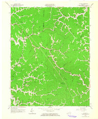
1962 Map of Ivyton
USGS Topo · Published 1964About this map
The Chesapeake and Ohio railroad corridor anchors the northern hills of this Magoffin County landscape, tracing the winding path of Jennys Creek through a region defined by narrow hollows and numerous gas wells. Small rural communities like Ivyton, Riceville, and Brainard serve as local hubs, connected by a network of unimproved roads and the primary State Road. The distribution of family-named cemeteries, such as the Trimble Cem and Hackworth Cem, alongside local institutions like the Needmore Sch and Chestnut Grove Ch, provides a clear view of the mid-century social geography of eastern Kentucky.
Find a feature on this map
75 named features on this map. Tap any name to fly to it.
Don’t see what you’re looking for? This feature index may not catch every label — zoom into the map to look around manually.
Map Details
Editions of this 1962 Ivyton Map
This is the sole edition of this map. No revisions or reprints were ever made.
Other maps of this area

1886 · Prestonsburg
USGS Topo · 1:125,000

1889 · Salyersville
USGS Topo · 1:125,000

1891 · Salyersville
USGS Topo · 1:125,000

1892 · Prestonsburg
USGS Topo · 1:125,000

1899 · Salyersville
USGS Topo · 1:125,000

1915 · Paintsville
USGS Topo · 1:48,000

1915 · Prestonsburg
USGS Topo · 1:62,500

1917 · Paintsville
USGS Topo · 1:62,500

1918 · Prestonsburg
USGS Topo · 1:62,500

1951 · Tiptop
USGS Topo · 1:24,000