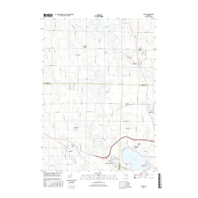
2015 Map of Ixonia
USGS Topo · Published 2015About this map
Ixonia and its surrounding wetlands occupy a landscape defined by the winding course of the Rock River and the Ashippun River. This 2015 U.S. Geological Survey representation documents the interface of three Wisconsin counties—Dodge, Jefferson, and Waukesha—at a time of established rural communities and expanding residential clusters near Lac La Belle. The map is particularly dense with genealogical sites, featuring several burial grounds such as Glenview Memorial Gardens and the Redemptionist Fathers Catholic Seminary Cem.
Find a feature on this map
110 named features on this map. Tap any name to fly to it.
Don’t see what you’re looking for? This feature index may not catch every label — zoom into the map to look around manually.
Map Details
Editions of this 2015 Ixonia Map
This is the sole edition of this map. No revisions or reprints were ever made.
Other maps of this area

1892 · Watertown
USGS Topo · 1:62,500

1892 · Oconomowoc
USGS Topo · 1:62,500

1894 · Watertown
USGS Topo · 1:62,500

1904 · Hartford
USGS Topo · 1:62,500

1909 · Oconomowoc
USGS Topo · 1:62,500

1955 · Horicon
USGS Topo · 1:62,500

1957 · Madison
USGS Topo · 1:250,000
1959 · Helenville
USGS Topo · 1:24,000

1959 · Ixonia
USGS Topo · 1:24,000
1959 · Oconomowoc East
USGS Topo · 1:24,000