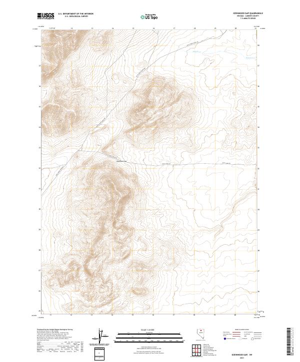
2021 Map of Izzenhood Gap
USGS Topo · Published 2021About this map
Izzenhood Gap serves as the focal point of this Lander County terrain, where the high desert landscape of central Nevada is defined by dramatic elevation changes. In the northern reaches of the quadrangle, Sixmile Cr cuts through the basin, providing a vital water source in an otherwise arid environment. The map details a network of rural access routes, including Rock Creek Ranch Rd and Rock Creek Rd, which trace the base of the ridges and provide connectivity between remote ranching outposts. This 2021 survey reflects the enduring character of the Great Basin, where land use is dictated by the availability of water and the navigable passes through the mountain ranges.
Find a feature on this map
8 named features on this map. Tap any name to fly to it.
Don’t see what you’re looking for? This feature index may not catch every label — zoom into the map to look around manually.
Map Details
Editions of this 2021 Izzenhood Gap Map
This is the sole edition of this map. No revisions or reprints were ever made.
Other maps of this area

1955 · McDermitt
USGS Topo · 1:250,000

1955 · Winnemucca
USGS Topo · 1:250,000

1958 · Winnemucca
USGS Topo · 1:250,000

1959 · McDermitt
USGS Topo · 1:250,000

1962 · Winnemucca
USGS Topo · 1:250,000

1965 · Izzenhood Gap
USGS Topo · 1:24,000

1965 · Russells
USGS Topo · 1:24,000

1965 · Sixmile Hill
USGS Topo · 1:24,000

1965 · Sheep Creek Range SW
USGS Topo · 1:24,000

1965 · Sheep Creek Range NW
USGS Topo · 1:24,000