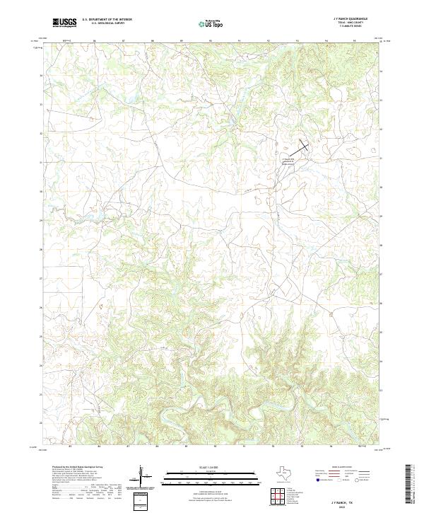
2022 Map of J Y Ranch
USGS Topo · Published 2022About this map
The Middle Fork Wichita River and the South Wichita River carve through this section of King County, defining a landscape of complex drainages and ranching heritage. This 2022 survey centers on the historic J Y Ranch-R B Masterson III Estate Airport, a private aviation landmark that reflects the large-scale landholdings characteristic of this part of West Texas.
Find a feature on this map
9 named features on this map. Tap any name to fly to it.
Don’t see what you’re looking for? This feature index may not catch every label — zoom into the map to look around manually.
Map Details
Editions of this 2022 J Y Ranch Map
This is the sole edition of this map. No revisions or reprints were ever made.
Other maps of this area

1954 · Lubbock
USGS Topo · 1:250,000

1966 · Ox Yoke Creek
USGS Topo · 1:24,000

1966 · Chalk SW
USGS Topo · 1:24,000

1966 · J Y Ranch
USGS Topo · 1:24,000

1966 · Lowrance Mountain
USGS Topo · 1:24,000

1967 · Dark Canyon
USGS Topo · 1:24,000

1967 · Fourmile Hill
USGS Topo · 1:24,000
1967 · Buzzard Peak
USGS Topo · 1:24,000

1968 · Grow
USGS Topo · 1:24,000

1968 · Guthrie
USGS Topo · 1:24,000