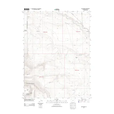
2013 Map of Jack Springs
USGS Topo · Published 2013About this map
Dinosaur National Monument occupies the western and southern reaches of this landscape, where the high elevation of Douglas Mountain drops into the complex drainage systems of the eastern plateau. The terrain is defined by a network of seasonal watercourses and topographic depressions, most notably the Zenobia Basin and the winding Vermillion Creek which cuts through the northern sections.
Find a feature on this map
25 named features on this map. Tap any name to fly to it.
Don’t see what you’re looking for? This feature index may not catch every label — zoom into the map to look around manually.
Map Details
Editions of this 2013 Jack Springs Map
This is the sole edition of this map. No revisions or reprints were ever made.
Other maps of this area

1954 · Lodore School
USGS Topo · 1:24,000

1954 · Canyon of Lodore South
USGS Topo · 1:24,000

1954 · Canyon of Lodore North
USGS Topo · 1:24,000

1954 · Vernal
USGS Topo · 1:250,000

1958 · Vernal
USGS Topo · 1:250,000

1960 · Vernal
USGS Topo · 1:250,000

1966 · Big Joe Basin
USGS Topo · 1:24,000

1966 · Irish Canyon
USGS Topo · 1:24,000
1966 · Greystone
USGS Topo · 1:24,000
1966 · Zenobia Peak
USGS Topo · 1:24,000