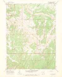
1966 Map of Zenobia Peak
USGS Topo · Published 1970About this map
Zenobia Peak and its surrounding Lookout Tower command the high ground of the Douglas Mountain uplift during this mid-1960s survey. This portion of Dinosaur National Monument in Moffat County reveals a landscape defined by seasonal water and isolated outposts. Long-established sites like Browns Cabin, Garrant Springs Ranch, and Tisdels Place mark the sparse human footprint in a region dominated by intricate drainage systems such as Warm Springs Draw and Holland Draw. In the south, the Yampa River carves through the terrain, while the eastern edge shows evidence of resource extraction at a lonely Mine near Peterson Valley. The map details a network of Jeep Trails that provided the primary access to landmarks like Vaughn & Reds Knob and the Ant Hills, illustrating the remote character of northwestern Colorado before modern expansion.
Find a feature on this map
26 named features on this map. Tap any name to fly to it.
Don’t see what you’re looking for? This feature index may not catch every label — zoom into the map to look around manually.
Map Details
Editions of this 1966 Zenobia Peak Map
3 editions found
Other maps of this area

1907 · Rangely
USGS Topo · 1:125,000

1910 · Rangely
USGS Topo · 1:125,000

1954 · Hells Canyon
USGS Topo · 1:24,000

1954 · Canyon of Lodore South
USGS Topo · 1:24,000

1954 · Canyon of Lodore North
USGS Topo · 1:24,000

1954 · Vernal
USGS Topo · 1:250,000

1958 · Vernal
USGS Topo · 1:250,000

1960 · Vernal
USGS Topo · 1:250,000

1962 · Tanks Peak
USGS Topo · 1:24,000
1962 · Haystack Rock
USGS Topo · 1:24,000