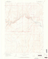
1962 Map of Indian Water Canyon
USGS Topo · Published 1965About this map
The Yampa River carves through the heart of Dinosaur National Monument in this mid-century survey of Moffat County. The landscape is defined by its dramatic relief, where the river winds past Thanksgiving Gorge and Anderson Hole while passing the flat expanse of Deerlodge Park. Human presence is marked by isolated structures such as Stuts Cabin and the Spurgion Cabins, suggesting a history of seasonal ranching or early recreational use before the formal establishment of the Deerlodge Park Campground.
Find a feature on this map
28 named features on this map. Tap any name to fly to it.
Don’t see what you’re looking for? This feature index may not catch every label — zoom into the map to look around manually.
Map Details
Editions of this 1962 Indian Water Canyon Map
2 editions found

Other maps of this area

1907 · Rangely
USGS Topo · 1:125,000

1907 · White River
USGS Topo · 1:125,000

1910 · White River
USGS Topo · 1:125,000

1910 · Rangely
USGS Topo · 1:125,000

1954 · Vernal
USGS Topo · 1:250,000

1958 · Vernal
USGS Topo · 1:250,000

1960 · Vernal
USGS Topo · 1:250,000

1960 · Elk Springs
USGS Topo · 1:62,500

1960 · Lone Mountain
USGS Topo · 1:62,500
1962 · M F Mountain
USGS Topo · 1:24,000