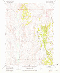
1969 Map of Lang Spring
USGS Topo · Published 1981About this map
Lang Spring provides a critical water source in this arid corner of Moffat County, which was surveyed by photogrammetric methods in the late 1960s. The landscape is dominated by the prominent elevation of Sevenmile Ridge, a feature that dictates the drainage patterns of the surrounding draws. Water distribution is further traced through named features like Spence Spring and the ephemeral course of Yellow Cat Wash. Evidence of resource exploration is visible at a specific Drill Hole in the northern sections, while a network of Jeep Trails provides the primary access through the broken terrain. The map captures the area as it appeared before the mid-1970s, documenting the seasonal watercourses of Dugout Draw and Sevenmile Draw that characterize this high desert environment.
Find a feature on this map
9 named features on this map. Tap any name to fly to it.
Don’t see what you’re looking for? This feature index may not catch every label — zoom into the map to look around manually.
Map Details
Editions of this 1969 Lang Spring Map
3 editions found
Other maps of this area

1954 · Vernal
USGS Topo · 1:250,000

1958 · Vernal
USGS Topo · 1:250,000

1958 · Maybell
USGS Topo · 1:62,500

1960 · Vernal
USGS Topo · 1:250,000

1960 · Lone Mountain
USGS Topo · 1:62,500

1969 · Reservoir Draw
USGS Topo · 1:24,000

1969 · The Nipple
USGS Topo · 1:24,000

1969 · Sheepherder Springs
USGS Topo · 1:24,000

1969 · Coffeepot Spring
USGS Topo · 1:24,000

1969 · Powder Wash
USGS Topo · 1:24,000