
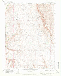
1969 Map of Coffeepot Spring
USGS Topo · Published 1973About this map
The Vermillion Bluffs dominate the central landscape of this Moffat County region, located just south of the Wyoming Colorado state line. This 1968 photogrammetric survey captures a high-desert environment defined by dramatic elevation changes and a scattered network of resource extraction. The area's hydrology is primarily seasonal, with drainages like Shell Creek and Beaver Draw cutting through the terrain, while the namesake Coffeepot Spring provides a rare localized water source in the southeastern corner. Industrial activity in the late 1960s is evident through multiple Drill Holes and a prominent Pipeline traversing the northern section near Shell. These features, alongside landmarks like Racetrack Flat and Yellow Cat Wash, reflect a remote territory shaped by both natural erosion and mid-century energy exploration.
Find a feature on this map
13 named features on this map. Tap any name to fly to it.
Don’t see what you’re looking for? This feature index may not catch every label — zoom into the map to look around manually.
Map Details
Editions of this 1969 Coffeepot Spring Map
This is the sole edition of this map. No revisions or reprints were ever made.
Other maps of this area

1954 · Vernal
USGS Topo · 1:250,000

1954 · Rock Springs
USGS Topo · 1:250,000

1958 · Vernal
USGS Topo · 1:250,000

1958 · Rock Springs
USGS Topo · 1:250,000

1960 · Vernal
USGS Topo · 1:250,000

1962 · Rock Springs
USGS Topo · 1:250,000

1966 · G Spring
USGS Topo · 1:24,000

1966 · Hiawatha
USGS Topo · 1:24,000
1968 · Chicken Creek SE
USGS Topo · 1:24,000

1969 · Sheepherder Springs
USGS Topo · 1:24,000