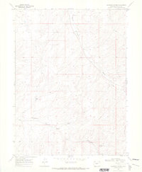
1969 Map of Mayberry Spring
USGS Topo · Published 1972About this map
Mayberry Spring and Clayton Spring serve as the primary named water sources in this high-desert landscape of Moffat County, surveyed at the end of the 1960s. The terrain is defined by a network of drainage patterns, most notably Bighole Gulch and Greasewood Gulch, which carve through the arid topography.
Find a feature on this map
8 named features on this map. Tap any name to fly to it.
Don’t see what you’re looking for? This feature index may not catch every label — zoom into the map to look around manually.
Map Details
Editions of this 1969 Mayberry Spring Map
2 editions found
Other maps of this area

1916 · Craig
USGS Topo · 1:125,000

1954 · Vernal
USGS Topo · 1:250,000

1954 · Craig
USGS Topo · 1:250,000

1957 · Craig
USGS Topo · 1:250,000

1958 · Vernal
USGS Topo · 1:250,000

1958 · Craig
USGS Topo · 1:250,000

1958 · Maybell
USGS Topo · 1:62,500

1960 · Craig
USGS Topo · 1:250,000

1960 · Vernal
USGS Topo · 1:250,000

1962 · Craig
USGS Topo · 1:250,000