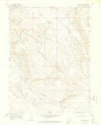
1966 Map of Big Joe Basin
USGS Topo · Published 1969About this map
Browns Park and the rugged basins of the eastern Uinta Basin periphery dominate this mid-1960s survey of northwestern Colorado. The landscape is defined by its water sources, with numerous named springs such as Cold Spring, Matt Spring, and Pablo Spring serving as vital landmarks in an arid environment. The map details the remote character of the region, where transit is restricted to a simple Jeep Trail or Pack Trail winding through high-relief terrain like Cold Spring Mountain and Limestone Ridge.
Find a feature on this map
29 named features on this map. Tap any name to fly to it.
Don’t see what you’re looking for? This feature index may not catch every label — zoom into the map to look around manually.
Map Details
Editions of this 1966 Big Joe Basin Map
2 editions found
Other maps of this area

1954 · Lodore School
USGS Topo · 1:24,000

1954 · Canyon of Lodore North
USGS Topo · 1:24,000

1954 · Vernal
USGS Topo · 1:250,000

1958 · Vernal
USGS Topo · 1:250,000

1960 · Vernal
USGS Topo · 1:250,000

1966 · Sugarloaf Butte
USGS Topo · 1:24,000
1966 · Beaver Basin
USGS Topo · 1:24,000

1966 · Big Joe Basin
USGS Topo · 1:24,000
1966 · Sparks
USGS Topo · 1:24,000

1966 · Irish Canyon
USGS Topo · 1:24,000