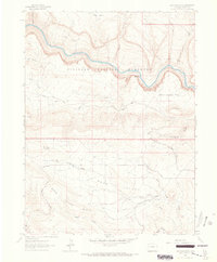
1962 Map of Haystack Rock
USGS Topo · Published 1966About this map
Yampa River meanders through the northern section of this 1960s quadrangle, carving a deep corridor through Dinosaur National Monument. The landscape is defined by dramatic elevation changes, where the river is flanked by landforms such as Haystack Rock and Lake Bench. To the south, the terrain rises toward the prominent Bear Valley Ridge, which overlooks the expansive Bear Valley.
Find a feature on this map
27 named features on this map. Tap any name to fly to it.
Don’t see what you’re looking for? This feature index may not catch every label — zoom into the map to look around manually.
Map Details
Editions of this 1962 Haystack Rock Map
2 editions found
Other maps of this area

1907 · Rangely
USGS Topo · 1:125,000

1910 · Rangely
USGS Topo · 1:125,000

1954 · Vernal
USGS Topo · 1:250,000

1958 · Vernal
USGS Topo · 1:250,000

1960 · Vernal
USGS Topo · 1:250,000

1962 · Lazy Y Point
USGS Topo · 1:24,000

1962 · Tanks Peak
USGS Topo · 1:24,000
1962 · M F Mountain
USGS Topo · 1:24,000
1962 · Skull Creek
USGS Topo · 1:24,000

1962 · Indian Water Canyon
USGS Topo · 1:24,000