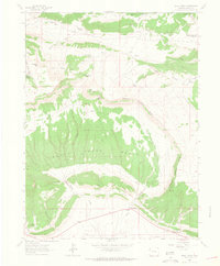
1962 Map of Skull Creek
USGS Topo · Published 1965About this map
Skull Creek Basin dominates this 1960s landscape, a natural amphitheater framed by the prominent Skull Creek Rim in Moffat County. The map details a period of isolated ranching and early resource extraction, evident in the presence of the Karren Ranch to the north and small Mines scattered across the complex topography. The small settlement of Massadona sits at the southern edge, serving as a waypoint in a terrain defined by intermittent drainages like Miller Creek and Elder Creek.
Find a feature on this map
30 named features on this map. Tap any name to fly to it.
Don’t see what you’re looking for? This feature index may not catch every label — zoom into the map to look around manually.
Map Details
Editions of this 1962 Skull Creek Map
2 editions found
Other maps of this area

1907 · Rangely
USGS Topo · 1:125,000

1910 · Rangely
USGS Topo · 1:125,000

1954 · Vernal
USGS Topo · 1:250,000

1958 · Vernal
USGS Topo · 1:250,000

1960 · Vernal
USGS Topo · 1:250,000

1962 · Lazy Y Point
USGS Topo · 1:24,000

1962 · Tanks Peak
USGS Topo · 1:24,000

1962 · Rangely NE
USGS Topo · 1:24,000

1962 · Cactus Reservoir
USGS Topo · 1:24,000
1962 · Divide Creek
USGS Topo · 1:24,000