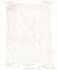
1969 Map of Sheepherder Springs
USGS Topo · Published 1972About this map
Sheepherder Springs serves as a vital water source in this arid high-desert landscape of northwestern Colorado. Surveyed in 1969, the topography is dominated by the prominent escarpment of the Vermilion Bluffs and the distinctive peak of Lookout Mtn. The map reveals a complex drainage network, where the North Fork Sand Wash and Sheepherder Springs Draw carve through the sedimentary layers. Human activity is sparse but evident through a solitary Drill Hole in the northwestern sector, indicating the mineral or geological exploration typical of Moffat County. The presence of Twin Buttes in the south provides a navigational landmark for a region defined by its significant relief and seasonal waterways like Lake Draw and Yellow Cat Wash.
Find a feature on this map
9 named features on this map. Tap any name to fly to it.
Don’t see what you’re looking for? This feature index may not catch every label — zoom into the map to look around manually.
Map Details
Editions of this 1969 Sheepherder Springs Map
2 editions found
Other maps of this area

1954 · Vernal
USGS Topo · 1:250,000

1958 · Vernal
USGS Topo · 1:250,000

1960 · Vernal
USGS Topo · 1:250,000

1960 · Lone Mountain
USGS Topo · 1:62,500

1966 · G Spring
USGS Topo · 1:24,000

1966 · Sheephead Basin
USGS Topo · 1:24,000

1966 · Hiawatha
USGS Topo · 1:24,000

1969 · Sheepherder Springs
USGS Topo · 1:24,000

1969 · Coffeepot Spring
USGS Topo · 1:24,000

1969 · Powder Wash
USGS Topo · 1:24,000