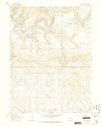
1962 Map of Tanks Peak
USGS Topo · Published 1965About this map
Dinosaur National Monument encompasses the northern portion of this landscape, where the Yampa River carves a dramatic series of loops through the sandstone. The river's path is marked by distinctive formations like Cleopatras Couch and the high vantage of Wagon Wheel Point, overlooking the Harding Hole encampment. South of the canyon rim, the terrain rises toward Tanks Peak, a high point that defines the local drainage patterns for numerous seasonal draws.
Find a feature on this map
38 named features on this map. Tap any name to fly to it.
Don’t see what you’re looking for? This feature index may not catch every label — zoom into the map to look around manually.
Map Details
Editions of this 1962 Tanks Peak Map
2 editions found
Other maps of this area

1907 · Rangely
USGS Topo · 1:125,000

1910 · Rangely
USGS Topo · 1:125,000

1954 · Hells Canyon
USGS Topo · 1:24,000

1954 · Canyon of Lodore South
USGS Topo · 1:24,000

1954 · Vernal
USGS Topo · 1:250,000

1958 · Vernal
USGS Topo · 1:250,000

1960 · Vernal
USGS Topo · 1:250,000

1962 · Lazy Y Point
USGS Topo · 1:24,000

1962 · Tanks Peak
USGS Topo · 1:24,000
1962 · Plug Hat Rock
USGS Topo · 1:24,000