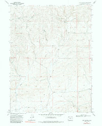
1969 Map of Iron Springs
USGS Topo · Published 1984About this map
Iron Springs and the surrounding high desert of Moffat County are defined by a complex network of seasonal drainages and essential water sources documented in the late 1960s. The landscape is characterized by deeply etched terrain including Bord Gulch and Dressler Gulch, which feed into the central artery of Lay Creek. These features illustrate the vital importance of water management in this arid region, as evidenced by various Spring labels and a designated Well located in the middle of the quadrangle. Industrial activity in the area is sparse but notable, marked by an occasional Drill Hole that suggests early exploration of the region's subsurface resources. The map highlights the vast, open character of northwestern Colorado before modern development, focusing on the natural topography and the few man-made interventions required to sustain life and industry in the high sagebrush country.
Find a feature on this map
9 named features on this map. Tap any name to fly to it.
Don’t see what you’re looking for? This feature index may not catch every label — zoom into the map to look around manually.
Map Details
Editions of this 1969 Iron Springs Map
2 editions found
Other maps of this area

1916 · Craig
USGS Topo · 1:125,000

1954 · Craig
USGS Topo · 1:250,000

1957 · Craig
USGS Topo · 1:250,000

1958 · Craig
USGS Topo · 1:250,000

1960 · Craig
USGS Topo · 1:250,000

1962 · Craig
USGS Topo · 1:250,000

1964 · Craig
USGS Topo · 1:250,000

1965 · Craig
USGS Topo · 1:250,000
1969 · Adobe Springs
USGS Topo · 1:24,000
1969 · Great Divide
USGS Topo · 1:24,000