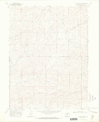
1969 Map of Adobe Springs
USGS Topo · Published 1972About this map
The high sagebrush and juniper country of Moffat County are defined by their vital water sources on this 1969 survey. Water management is central to life in this arid landscape, evidenced by the presence of Adobe Springs Creek and several unnamed springs that dot the terrain. The local community center of gravity is represented by the Spring Creek Cem, situated near the banks of Spring Creek. Human infrastructure is sparse but significant, with a long Pipeline cutting across the northwest corner of the map, signaling the importance of resource transport in this part of Colorado. The map traces the natural drainage patterns where the West Prong meets other seasonal watercourses, illustrating how the topography dictates the movement of water and livestock through the high desert range.
Find a feature on this map
10 named features on this map. Tap any name to fly to it.
Don’t see what you’re looking for? This feature index may not catch every label — zoom into the map to look around manually.
Map Details
Editions of this 1969 Adobe Springs Map
4 editions found
Other maps of this area

1916 · Craig
USGS Topo · 1:125,000

1954 · Vernal
USGS Topo · 1:250,000

1954 · Craig
USGS Topo · 1:250,000

1957 · Craig
USGS Topo · 1:250,000

1958 · Vernal
USGS Topo · 1:250,000

1958 · Craig
USGS Topo · 1:250,000

1958 · Maybell
USGS Topo · 1:62,500

1960 · Craig
USGS Topo · 1:250,000

1960 · Vernal
USGS Topo · 1:250,000

1962 · Craig
USGS Topo · 1:250,000