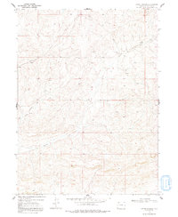
1969 Map of Adobe Springs
USGS Topo · Published 1992About this map
The high plateau country of Moffat County is defined by a sparse but vital network of water and infrastructure in this late-1960s survey. Much of the activity centers on the Adobe Springs Creek drainage, where the small Spring Creek Cem serves as a quiet marker of early settlement in an otherwise remote landscape. This period of the late twentieth century saw significant industrial utility projects across the region, represented here by the prominent Pipeline corridors cutting across the western sections. The terrain is deeply incised by intermittent drainage patterns, including the headwaters of West Prong Creek, revealing a landscape where topography dictated the placement of ranch roads and remote homesteading sites.
Find a feature on this map
5 named features on this map. Tap any name to fly to it.
Don’t see what you’re looking for? This feature index may not catch every label — zoom into the map to look around manually.
Map Details
Editions of this 1969 Adobe Springs Map
4 editions found
Other maps of this area

1916 · Craig
USGS Topo · 1:125,000

1954 · Vernal
USGS Topo · 1:250,000

1954 · Craig
USGS Topo · 1:250,000

1957 · Craig
USGS Topo · 1:250,000

1958 · Vernal
USGS Topo · 1:250,000

1958 · Craig
USGS Topo · 1:250,000

1958 · Maybell
USGS Topo · 1:62,500

1960 · Craig
USGS Topo · 1:250,000

1960 · Vernal
USGS Topo · 1:250,000

1962 · Craig
USGS Topo · 1:250,000