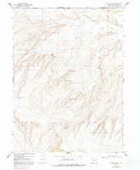
1969 Map of Powder Wash
USGS Topo · Published 1991About this map
Powder Wash and the surrounding high desert terrain define this landscape at the northern edge of Moffat County, where industrial development meets the arid canyons of the West. This 1969 field-checked survey highlights the early energy infrastructure of the region, marked by a Pumping Sta, numerous Oil Well sites, and a prominent Pipeline cutting across the drainages. The complex network of water features, such as West Dripping Rock Spring and Deep Hole Spring, indicates the vital importance of water sources in an area dominated by dry washes like Beaver Slide Draw and Ace in the Hole Draw. Straddling the state line between Colorado and Wyoming, the map captures a period of transition where remote resource extraction was establishing a permanent footprint in the rugged basin, evidenced by the scattered Drill Hole markers and the Gravel Pit near the southern boundary.
Find a feature on this map
17 named features on this map. Tap any name to fly to it.
Don’t see what you’re looking for? This feature index may not catch every label — zoom into the map to look around manually.
Map Details
Editions of this 1969 Powder Wash Map
3 editions found

Other maps of this area

1954 · Vernal
USGS Topo · 1:250,000

1954 · Rock Springs
USGS Topo · 1:250,000

1958 · Vernal
USGS Topo · 1:250,000

1958 · Rock Springs
USGS Topo · 1:250,000

1960 · Vernal
USGS Topo · 1:250,000

1962 · Rock Springs
USGS Topo · 1:250,000

1969 · Reservoir Draw
USGS Topo · 1:24,000

1969 · The Nipple
USGS Topo · 1:24,000

1969 · Sheepherder Springs
USGS Topo · 1:24,000

1969 · Coffeepot Spring
USGS Topo · 1:24,000