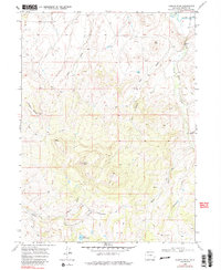
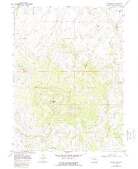
1969 Map of Bakers Peak
USGS Topo · Published 1988About this map
Bakers Peak and the high ridges of Serviceberry Mountain dominate this landscape in Moffat County, where complex drainage systems define the high-elevation terrain. To the north, the Little Snake River flows near a Gaging Sta, while the southeastern portion of the quadrangle is marked by the distinct Smith Rim and Ovo Reservoir. The map illustrates a remote wilderness characterized by a network of seasonal watercourses like Jack Rabbit Creek, Slater Creek, and Mule Creek, which cut through the steep topography.
Find a feature on this map
19 named features on this map. Tap any name to fly to it.
Don’t see what you’re looking for? This feature index may not catch every label — zoom into the map to look around manually.
Map Details
Editions of this 1969 Bakers Peak Map
5 editions found
Other maps of this area

1916 · Craig
USGS Topo · 1:125,000

1932 · Savery
USGS Topo · 1:96,000

1940 · Savery
USGS Topo · 1:125,000

1954 · Rawlins
USGS Topo · 1:250,000

1954 · Craig
USGS Topo · 1:250,000

1957 · Craig
USGS Topo · 1:250,000

1957 · Baggs
USGS Topo · 1:62,500

1958 · Rawlins
USGS Topo · 1:250,000

1958 · Craig
USGS Topo · 1:250,000

1960 · Craig
USGS Topo · 1:250,000