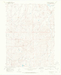
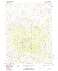
1969 Map of Bakers Peak
USGS Topo · Published 1972About this map
Bakers Peak and Serviceberry Mountain dominate this corner of Northwest Colorado, where the high-altitude landscape is defined by its complex drainage network and early communication infrastructure. The Little Snake River flows along the northern edge, supported by numerous named tributaries like Jack Rabbit Creek and Slater Creek. The presence of a Radio Facility and a Gaging Sta near the river indicates the mid-century importance of monitoring both the airwaves and water levels in this cattle and sheep-raising country. A network of primitive transport is visible through the Jeep Trail systems that traverse the Smith Rim and connect isolated water sources such as Box Spring and the OVO Reservoir. These features suggest a working ranching landscape, where every spring and draw was named for navigation across the high plateaus.
Find a feature on this map
20 named features on this map. Tap any name to fly to it.
Don’t see what you’re looking for? This feature index may not catch every label — zoom into the map to look around manually.
Map Details
Editions of this 1969 Bakers Peak Map
5 editions found
Other maps of this area

1916 · Craig
USGS Topo · 1:125,000

1932 · Savery
USGS Topo · 1:96,000

1940 · Savery
USGS Topo · 1:125,000

1954 · Rawlins
USGS Topo · 1:250,000

1954 · Craig
USGS Topo · 1:250,000

1957 · Craig
USGS Topo · 1:250,000

1957 · Baggs
USGS Topo · 1:62,500

1958 · Rawlins
USGS Topo · 1:250,000

1958 · Craig
USGS Topo · 1:250,000

1960 · Craig
USGS Topo · 1:250,000