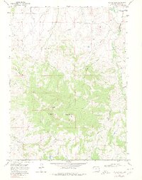
1969 Map of Bakers Peak
USGS Topo · Published 1980About this map
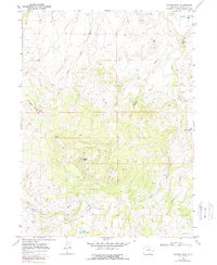
Bakers Peak stands as the central landmark in this high-elevation landscape of Moffat County, surveyed in the late 1960s. The terrain is defined by a series of prominent summits, including Jim Robertson Mountain and Little Emerson Peak, which rise above the surrounding drainage networks. The northern boundary is marked by the winding course of the Little Snake River, which receives water from numerous seasonal tributaries such as Slater Creek and Mule Creek.
Find a feature on this map
21 named features on this map. Tap any name to fly to it.
Don’t see what you’re looking for? This feature index may not catch every label — zoom into the map to look around manually.
Map Details
Editions of this 1969 Bakers Peak Map
5 editions found
Other maps of this area

1916 · Craig
USGS Topo · 1:125,000

1932 · Savery
USGS Topo · 1:96,000

1940 · Savery
USGS Topo · 1:125,000

1954 · Rawlins
USGS Topo · 1:250,000

1954 · Craig
USGS Topo · 1:250,000

1957 · Craig
USGS Topo · 1:250,000

1957 · Baggs
USGS Topo · 1:62,500

1958 · Rawlins
USGS Topo · 1:250,000

1958 · Craig
USGS Topo · 1:250,000

1960 · Craig
USGS Topo · 1:250,000