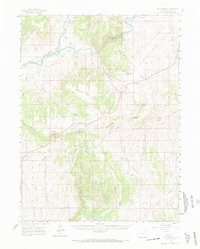
1960 Map of Elk Springs
USGS Topo · Published 1969About this map
Elk Ridge and Coal Ridge dominate this corner of Moffat County, where the high desert plateau is carved by an intricate network of drainages and canyons. The Yampa River flows through the northern reaches, joined by the Little Snake River near Lily Park, a local landmark that anchors the river-bottom landscape. This mid-century survey records a remote ranching economy, mapping family operations such as the Rinker Ranch, White Bear Ranch, and Weaver Ranch scattered along the gulches.
Find a feature on this map
46 named features on this map. Tap any name to fly to it.
Don’t see what you’re looking for? This feature index may not catch every label — zoom into the map to look around manually.
Map Details
Editions of this 1960 Elk Springs Map
4 editions found
Other maps of this area

1907 · Rangely
USGS Topo · 1:125,000

1907 · White River
USGS Topo · 1:125,000

1910 · White River
USGS Topo · 1:125,000

1910 · Rangely
USGS Topo · 1:125,000

1954 · Vernal
USGS Topo · 1:250,000

1958 · Vernal
USGS Topo · 1:250,000

1958 · Maybell
USGS Topo · 1:62,500

1958 · Citadel Plateau
USGS Topo · 1:62,500

1960 · Vernal
USGS Topo · 1:250,000

1960 · Elk Springs
USGS Topo · 1:62,500