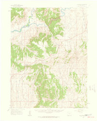
1960 Map of Elk Springs
USGS Topo · Published 1962About this map
The confluence of the Snake River and Yampa River anchors this 1960s landscape, where the waters pass through the steep Cross Mountain Canyon. This rugged portion of Moffat County is defined by a series of high-altitude features including Twelvemile Mesa and the expansive Pinyon Ridge. The map documents a sparse, ranch-based economy typical of the high desert at mid-century, marking established family holdings such as White Bear Ranch, Rinker Ranch, and Tuttle Ranch.
Find a feature on this map
32 named features on this map. Tap any name to fly to it.
Don’t see what you’re looking for? This feature index may not catch every label — zoom into the map to look around manually.
Map Details
Editions of this 1960 Elk Springs Map
4 editions found
Other maps of this area

1907 · Rangely
USGS Topo · 1:125,000

1907 · White River
USGS Topo · 1:125,000

1910 · White River
USGS Topo · 1:125,000

1910 · Rangely
USGS Topo · 1:125,000

1954 · Vernal
USGS Topo · 1:250,000

1958 · Vernal
USGS Topo · 1:250,000

1958 · Maybell
USGS Topo · 1:62,500

1958 · Citadel Plateau
USGS Topo · 1:62,500

1960 · Vernal
USGS Topo · 1:250,000

1960 · Elk Springs
USGS Topo · 1:62,500