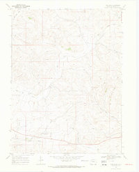
1969 Map of Pine Ridge
USGS Topo · Published 1973About this map
Pine Ridge and the surrounding Moffat County uplands are documented here during the late 1960s, showing a landscape defined by seasonal watercourses and resource exploration. The topography is dominated by Sevenmile Hill and the drainage network of Big Gulch, which cuts through the central terrain. Human activity is primarily represented by industrial markers and water management, such as a Gravel Pit and several sites labeled Drill Hole. These features, alongside Sand Spring and the Bogenschutz Creek, indicate a reliance on scarce water sources in this high-plains environment. The presence of multiple locations simply marked Well further illustrates the pastoral and extractive infrastructure of the region during this era.
Find a feature on this map
8 named features on this map. Tap any name to fly to it.
Don’t see what you’re looking for? This feature index may not catch every label — zoom into the map to look around manually.
Map Details
Editions of this 1969 Pine Ridge Map
2 editions found
Other maps of this area

1910 · Danforth Hills
USGS Topo · 1:125,000

1912 · Axial
USGS Topo · 1:62,500

1914 · Axial
USGS Topo · 1:62,500

1915 · Monument Butte
USGS Topo · 1:62,500

1916 · Craig
USGS Topo · 1:125,000

1954 · Craig
USGS Topo · 1:250,000

1957 · Craig
USGS Topo · 1:250,000

1958 · Craig
USGS Topo · 1:250,000

1960 · Craig
USGS Topo · 1:250,000

1962 · Craig
USGS Topo · 1:250,000