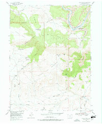
1954 Map of Hells Canyon
USGS Topo · Published 1978About this map
The Yampa River winds through the heart of the Dinosaur National Monument in this mid-century survey, revealing a landscape where ranching history meets protected wilderness. Settlement patterns are sparse, defined by family-named landmarks such as the Mantle Ranch and the nearby Mantle Sch, which served the small community in this isolated canyon environment. The map documents several sites already noted as being of an earlier era, including the Red Rock Ranch (Aban'd), Fred Wall Place (Aban'd), and Caldwell Place (Aban'd), offering a vital record for genealogists tracking these pioneer families.
Find a feature on this map
48 named features on this map. Tap any name to fly to it.
Don’t see what you’re looking for? This feature index may not catch every label — zoom into the map to look around manually.
Map Details
Editions of this 1954 Hells Canyon Map
5 editions found
Other maps of this area

1885 · Ashley
USGS Topo · 1:250,000

1907 · Rangely
USGS Topo · 1:125,000

1907 · Jensen
USGS Topo · 1:125,000

1910 · Jensen
USGS Topo · 1:125,000

1910 · Rangely
USGS Topo · 1:125,000

1954 · Hells Canyon
USGS Topo · 1:24,000

1954 · Canyon of Lodore South
USGS Topo · 1:24,000

1954 · Vernal
USGS Topo · 1:250,000

1955 · Stuntz Reservoir
USGS Topo · 1:24,000

1955 · Jones Hole
USGS Topo · 1:24,000