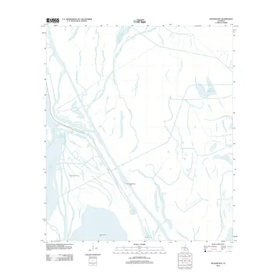
2012 Map of Jackass Bay
USGS Topo · Published 2012About this map
Grand Bayou and a intricate network of waterways dominate this Iberia Parish landscape, illustrating the complex hydrography of the Atchafalaya Basin in the early 21st century. The map highlights the intersection of natural drainage and industrial extraction, most notably at the Fausse Pointe Oil Field and the Fish Island Gas Field. These energy sites are linked to the surrounding terrain by specialized infrastructure like Bayou Benoit Levee Rd and Shell Rd, which navigate the wetlands and levee systems. Named features like Four Hundred Dollar Bayou and Little Gonsoulin Bayou suggest a landscape shaped by local history and family legacy. Large-scale water management is evident in the Lake Fausse Pointe Cut, which provides a direct navigable route between the bayous and Little Lake Long.
Find a feature on this map
20 named features on this map. Tap any name to fly to it.
Don’t see what you’re looking for? This feature index may not catch every label — zoom into the map to look around manually.
Map Details
Editions of this 2012 Jackass Bay Map
This is the sole edition of this map. No revisions or reprints were ever made.
Other maps of this area

1935 · Chicot Lake
USGS Topo · 1:62,500

1937 · Jeanerette
USGS Topo · 1:62,500

1941 · Loreauville
USGS Topo · 1:62,500

1945 · New Orleans
USGS Topo · 1:250,000

1948 · Foster
USGS Topo · 1:62,500

1953 · Pigeon Bay
USGS Topo · 1:24,000

1954 · Chicot Lake
USGS Topo · 1:62,500

1954 · Loreauville
USGS Topo · 1:62,500

1954 · Jeanerette
USGS Topo · 1:62,500

1954 · Baton Rouge
USGS Topo · 1:250,000