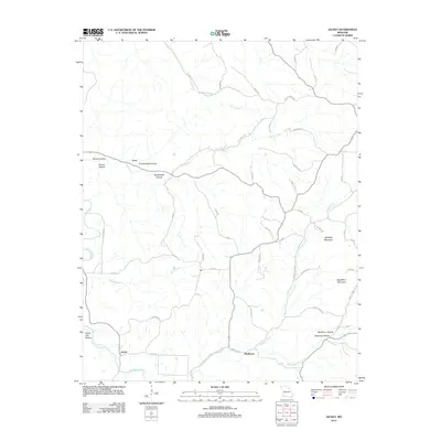
2012 Map of Jacket
USGS Topo · Published 2012About this map
Big Sugar Creek winds through the southwestern corner of this landscape, marking a significant drainage for the surrounding hills of McDonald County. The tiny settlements of Jacket and Mayflower anchor the southern reaches of the map, while Cove is positioned in the northwest. This area is defined by a complex network of hollows, including Pendergraff Hollow and Cracker Neck Hollow, which illustrate the deep dissection of the terrain by tributaries like Brush Creek and Trent Creek. In the eastern half, the prominence of Oakleigh Mountain and Eggleston Mountain rises above the valley of Greasy Creek. A intricate system of forest roads and local routes, such as Flag Springs Rd and Spook Rd, connects these isolated valleys and ridges, reflecting the rural character and topographic constraints of the region in the early 21st century.
Find a feature on this map
54 named features on this map. Tap any name to fly to it.
Don’t see what you’re looking for? This feature index may not catch every label — zoom into the map to look around manually.
Map Details
Editions of this 2012 Jacket Map
This is the sole edition of this map. No revisions or reprints were ever made.
Other maps of this area

1899 · Fayetteville
USGS Topo · 1:125,000

1900 · Eureka Springs
USGS Topo · 1:125,000

1901 · Eureka Springs
USGS Topo · 1:125,000

1901 · Fayetteville
USGS Topo · 1:125,000

1904 · Fayetteville
USGS Topo · 1:125,000

1937 · Cassville
USGS Topo · 1:48,000

1941 · Rocky Comfort
USGS Topo · 1:62,500

1943 · Rocky Comfort
USGS Topo · 1:62,500

1944 · Cassville
USGS Topo · 1:62,500

1945 · Harrison
USGS Topo · 1:250,000