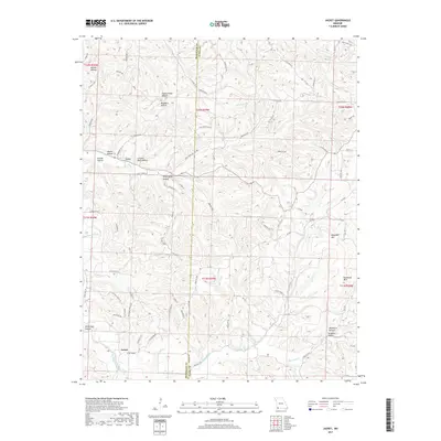
2017 Map of Jacket
USGS Topo · Published 2017About this map
Jacket sits at the southwestern edge of this landscape in the Missouri Ozarks, positioned where Big Sugar Creek and Otter Cr meet. The area is defined by a dense network of hollows and ridges, with family-named features like Pigeon Roost Hollow, Woodard Hollow, and Cracker Neck Hollow carving deep into the terrain. Historical travel patterns are evident in the winding path of the Old Mail Route Rd, which likely followed the easier grades of the ridgelines before modern infrastructure was established.
Find a feature on this map
94 named features on this map. Tap any name to fly to it.
Don’t see what you’re looking for? This feature index may not catch every label — zoom into the map to look around manually.
Map Details
Editions of this 2017 Jacket Map
This is the sole edition of this map. No revisions or reprints were ever made.
Other maps of this area

1899 · Fayetteville
USGS Topo · 1:125,000

1900 · Eureka Springs
USGS Topo · 1:125,000

1901 · Eureka Springs
USGS Topo · 1:125,000

1901 · Fayetteville
USGS Topo · 1:125,000

1904 · Fayetteville
USGS Topo · 1:125,000

1937 · Cassville
USGS Topo · 1:48,000

1941 · Rocky Comfort
USGS Topo · 1:62,500

1943 · Rocky Comfort
USGS Topo · 1:62,500

1944 · Cassville
USGS Topo · 1:62,500

1945 · Harrison
USGS Topo · 1:250,000