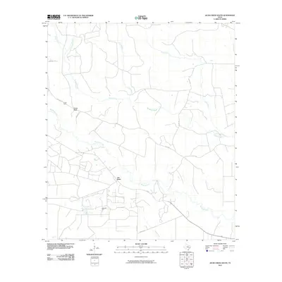
2010 Map of Jacks Creek South
USGS Topo · Published 2010About this map
Camp Seale and the surrounding piney woods of Polk County are defined by a network of rural routes and waterway drainages in this 2010 survey. The landscape is heavily influenced by local industry, most notably at the Segno Oil Field near the southern boundary, where Prime-Oilfield Loop and Buddy Brown Rd provide access to extraction sites. The settlement of Oak Shade sits centrally located at a crossroads, serving as a landmark in a terrain otherwise dominated by the winding paths of Big Sandy Creek and Cypress Creek. A complex system of county roads, including Camp Seale Rd and Frontier Rd, connects these isolated communities and industrial zones. The hydrography is particularly detailed, tracing the headwaters of Kimball Creek, Little Kimball Creek, and Jacks Creek as they weave through the East Texas timberlands.
Find a feature on this map
24 named features on this map. Tap any name to fly to it.
Don’t see what you’re looking for? This feature index may not catch every label — zoom into the map to look around manually.
Map Details
Editions of this 2010 Jacks Creek South Map
This is the sole edition of this map. No revisions or reprints were ever made.
Other maps of this area

1943 · Liberty
USGS Topo · 1:125,000

1954 · Beaumont
USGS Topo · 1:250,000

1955 · Saratoga
USGS Topo · 1:62,500

1955 · Kountze
USGS Topo · 1:62,500

1957 · Beaumont
USGS Topo · 1:250,000

1958 · Segno
USGS Topo · 1:62,500

1958 · Warren
USGS Topo · 1:62,500

1984 · Segno
USGS Topo · 1:24,000

1984 · Beaumont
USGS Topo · 1:250,000

1984 · Jacks Creek South
USGS Topo · 1:24,000