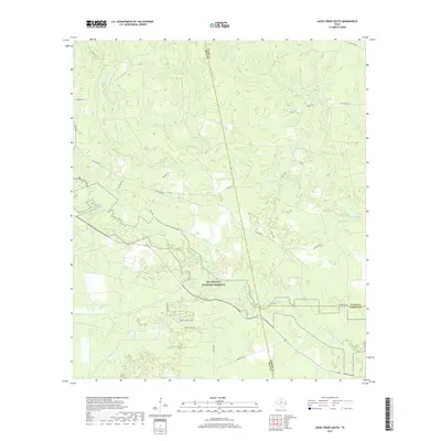
2019 Map of Jacks Creek South
USGS Topo · Published 2019About this map
Big Thicket National Preserve occupies a significant portion of this landscape, where the borders of Polk, Tyler, and Hardin counties converge. The terrain is defined by a dense network of waterways, with the meandering course of Big Sandy Cr serving as a central drainage feature. Numerous smaller tributaries, including Cypress Cr, Long Br, and Kimball Cr, weave through the piney woods and wetlands characteristic of this Southeast Texas region.
Find a feature on this map
31 named features on this map. Tap any name to fly to it.
Don’t see what you’re looking for? This feature index may not catch every label — zoom into the map to look around manually.
Map Details
Editions of this 2019 Jacks Creek South Map
This is the sole edition of this map. No revisions or reprints were ever made.
Other maps of this area

1943 · Liberty
USGS Topo · 1:125,000

1954 · Beaumont
USGS Topo · 1:250,000

1955 · Saratoga
USGS Topo · 1:62,500

1955 · Kountze
USGS Topo · 1:62,500

1957 · Beaumont
USGS Topo · 1:250,000

1958 · Segno
USGS Topo · 1:62,500

1958 · Warren
USGS Topo · 1:62,500

1984 · Segno
USGS Topo · 1:24,000

1984 · Beaumont
USGS Topo · 1:250,000

1984 · Jacks Creek South
USGS Topo · 1:24,000