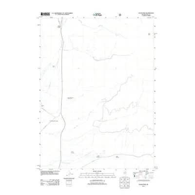
2012 Map of Jacks Peak
USGS Topo · Published 2012About this map
Independence Valley serves as the focal point for this high-desert ranching landscape in northern Nevada, where water management defines the settlement patterns. The sparse development is anchored by significant local holdings such as Andrae Ranch and Spanish Ranch, connected by rugged local arteries like Spanish Ranch Rd and River Ranch Rd. A network of drainage systems, including Bull Creek and Niagara Creek, flows from the surrounding high country toward the valley floor. To the east, the topography rises sharply toward Jacks Peak, while the southern portion of the quadrangle is deeply incised by Snow Canyon, Jerritt Canyon, and Cow Canyon. This 2012 survey illustrates the modern continuation of traditional Great Basin land use, featuring the Jack Creek Ranch Landing Strip as a modern necessity for these isolated northern Nevada ranching operations.
Find a feature on this map
21 named features on this map. Tap any name to fly to it.
Don’t see what you’re looking for? This feature index may not catch every label — zoom into the map to look around manually.
Map Details
Editions of this 2012 Jacks Peak Map
This is the sole edition of this map. No revisions or reprints were ever made.
Other maps of this area

1955 · McDermitt
USGS Topo · 1:250,000

1955 · Wells
USGS Topo · 1:250,000

1956 · Tuscarora
USGS Topo · 1:62,500

1956 · Bull Run
USGS Topo · 1:62,500

1956 · Wild Horse
USGS Topo · 1:62,500

1958 · Wells
USGS Topo · 1:250,000

1959 · McDermitt
USGS Topo · 1:250,000

1961 · Wells
USGS Topo · 1:250,000

1971 · Mahala Creek West
USGS Topo · 1:24,000

1971 · California Mtn.
USGS Topo · 1:24,000