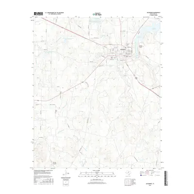
2016 Map of Jacksboro
USGS Topo · Published 2016About this map
Jacksboro serves as the focal point of this North Texas survey, where the town grid is defined by a dense network of local streets such as Wichita Ave and North Main St. The landscape surrounding the community is heavily managed for water resources, featuring several designated sites like the Soil Conservation Service Site 20 Reservoir and the larger Lost Creek Reservoir. This engineering reflect the region's reliance on controlled watersheds for local industry and agriculture.
Find a feature on this map
78 named features on this map. Tap any name to fly to it.
Don’t see what you’re looking for? This feature index may not catch every label — zoom into the map to look around manually.
Map Details
Editions of this 2016 Jacksboro Map
This is the sole edition of this map. No revisions or reprints were ever made.
Other maps of this area

1954 · Wichita Falls
USGS Topo · 1:250,000

1958 · Wichita Falls
USGS Topo · 1:250,000

1960 · Jacksboro
USGS Topo · 1:24,000
1961 · Bartons Chapel
USGS Topo · 1:24,000
1961 · Perrin
USGS Topo · 1:24,000

1961 · Jacksboro NE
USGS Topo · 1:24,000

1964 · Senate
USGS Topo · 1:24,000

1964 · Cundiff
USGS Topo · 1:24,000

1964 · Johnson Lake
USGS Topo · 1:24,000

1964 · Lynn Creek
USGS Topo · 1:24,000