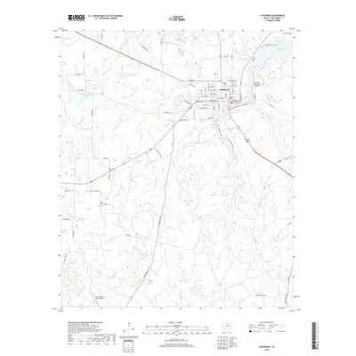
2019 Map of Jacksboro
USGS Topo · Published 2019About this map
Jacksboro serves as the focal point of this North Texas survey, positioned where the watershed of Lost Creek meets the northern reaches of the West Fork Keechi Creek drainage. The landscape is defined by its transition from the town's grid to a network of rural roads such as Wesley Chapel Road and Sand Flat Road, reflecting a long history of ranching and early settlement. Notable landmarks include the Fort Richardson Spring and Park Spring, which highlight the area's natural water sources that once sustained frontier travelers.
Find a feature on this map
74 named features on this map. Tap any name to fly to it.
Don’t see what you’re looking for? This feature index may not catch every label — zoom into the map to look around manually.
Map Details
Editions of this 2019 Jacksboro Map
This is the sole edition of this map. No revisions or reprints were ever made.
Other maps of this area

1954 · Wichita Falls
USGS Topo · 1:250,000

1958 · Wichita Falls
USGS Topo · 1:250,000

1960 · Jacksboro
USGS Topo · 1:24,000
1961 · Bartons Chapel
USGS Topo · 1:24,000
1961 · Perrin
USGS Topo · 1:24,000

1961 · Jacksboro NE
USGS Topo · 1:24,000

1964 · Senate
USGS Topo · 1:24,000

1964 · Cundiff
USGS Topo · 1:24,000

1964 · Johnson Lake
USGS Topo · 1:24,000

1964 · Lynn Creek
USGS Topo · 1:24,000