
1961 Map of Jacksboro NE
USGS Topo · Published 1963About this map
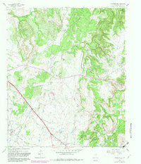
The Rusmag Oil Field dominates the southern landscape of this Jack County survey, reflecting the intensive energy extraction defining the region in the early 1960s. Scattered Oil Wells and a network of pipelines crisscross the terrain, which is naturally drained by several winding waterways including Carroll Creek and Snake Creek. In the northeast corner, the rising waters of Lake Bridgeport begin to fill the valley of Crooked Creek, illustrating the intersection of industrial development and water management.
Find a feature on this map
17 named features on this map. Tap any name to fly to it.
Don’t see what you’re looking for? This feature index may not catch every label — zoom into the map to look around manually.
Map Details
Editions of this 1961 Jacksboro NE Map
2 editions found
Other maps of this area

1954 · Sherman
USGS Topo · 1:250,000

1954 · Wichita Falls
USGS Topo · 1:250,000

1958 · Wichita Falls
USGS Topo · 1:250,000

1958 · Sherman
USGS Topo · 1:250,000

1960 · Gibtown
USGS Topo · 1:24,000

1960 · Wizard Wells
USGS Topo · 1:24,000

1960 · Jacksboro
USGS Topo · 1:24,000
1961 · Bartons Chapel
USGS Topo · 1:24,000
1961 · Perrin
USGS Topo · 1:24,000

1961 · Crafton
USGS Topo · 1:24,000