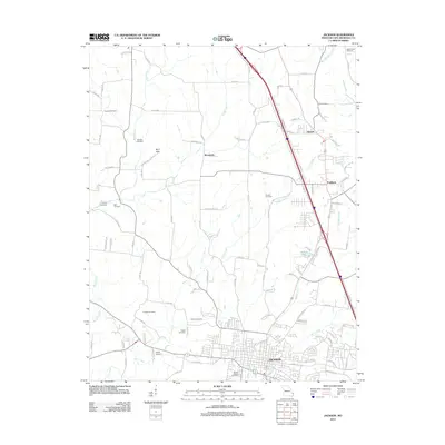
2012 Map of Jackson
USGS Topo · Published 2012About this map
Jackson anchors the southern edge of this region in Cape Girardeau County, where a network of rural roads and creek valleys defines the transition between the growing municipality and the surrounding farmland. The landscape is notably dotted with small family and community burial grounds, including the Clippard Cemetery, Wheeler Cemetery, and Ramsey Cemetery, which reflect generations of local settlement patterns. To the north, the communities of Brookside, Sawyer, and Fruitland are linked by arterial routes that follow the natural topography shaped by Byrd Creek, Cane Creek, and Hubble Creek. These waterways, along with the Byrd Hills, create a rolling relief that has dictated the placement of homesteads and modern developments. The presence of Shiloh Camp and various cemeteries like Russell Heights Cemetery suggests a well-established social and genealogical record etched into the hills and valleys north of the county seat.
Find a feature on this map
95 named features on this map. Tap any name to fly to it.
Don’t see what you’re looking for? This feature index may not catch every label — zoom into the map to look around manually.
Map Details
Editions of this 2012 Jackson Map
This is the sole edition of this map. No revisions or reprints were ever made.
Other maps of this area

1918 · Altenburg
USGS Topo · 1:62,500

1922 · Cape Girardeau
USGS Topo · 1:62,500

1923 · Perryville
USGS Topo · 1:62,500

1924 · Cape Girardeau
USGS Topo · 1:62,500

1924 · Perryville
USGS Topo · 1:62,500

1925 · Altenburg
USGS Topo · 1:62,500

1933 · Marble Hill
USGS Topo · 1:62,500

1937 · Marble Hill
USGS Topo · 1:62,500

1947 · Oak Ridge
USGS Topo · 1:24,000

1947 · Altenburg
USGS Topo · 1:62,500