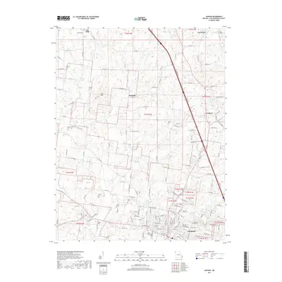
2017 Map of Jackson
USGS Topo · Published 2017About this map
The city of Jackson anchors the southern portion of this landscape, where the confluence of Goose Cr and Hubble Cr meets the residential grid. This area of Cape Girardeau County is notable for its high density of family and community burial grounds, including the large Russell Heights Cem and smaller, more isolated sites like Clipped Cem and Ramsey Cem. The terrain transitions from the developed streets of the county seat toward the rolling elevations of the Byrd Hills and the unincorporated communities of Fruitland and Brookside. Traces of earlier infrastructure are visible in the winding path of Old Toll Rd, which cuts across the central section near Cane Cr. To the north, the rural landscape is defined by agricultural lands surrounding Oak Ridge and Pocahontas, connected by a network of county roads like Co Rd 450 that bridge the many branches of Byrd Cr and Horrell Cr.
Find a feature on this map
149 named features on this map. Tap any name to fly to it.
Don’t see what you’re looking for? This feature index may not catch every label — zoom into the map to look around manually.
Map Details
Editions of this 2017 Jackson Map
This is the sole edition of this map. No revisions or reprints were ever made.
Other maps of this area

1918 · Altenburg
USGS Topo · 1:62,500

1922 · Cape Girardeau
USGS Topo · 1:62,500

1923 · Perryville
USGS Topo · 1:62,500

1924 · Cape Girardeau
USGS Topo · 1:62,500

1924 · Perryville
USGS Topo · 1:62,500

1925 · Altenburg
USGS Topo · 1:62,500

1933 · Marble Hill
USGS Topo · 1:62,500

1937 · Marble Hill
USGS Topo · 1:62,500

1947 · Oak Ridge
USGS Topo · 1:24,000

1947 · Altenburg
USGS Topo · 1:62,500