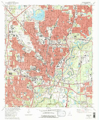
1980 Map of Jackson
USGS Topo · Published 1981About this map
The State Capitol stands at the heart of Mississippi's capital city, serving as the focal point for a dense grid of government and civic architecture. By the early 1980s, the urban core was well-defined, showing the Coliseum, the Courthouse, and the expansive Univ of Mississippi Medical Center complex. The capital's infrastructure is underscored by the Illinois Central Gulf railroad lines and the winding course of the Pearl River, which forms the boundary between Hinds and Rankin counties.
Find a feature on this map
119 named features on this map. Tap any name to fly to it.
Don’t see what you’re looking for? This feature index may not catch every label — zoom into the map to look around manually.
Map Details
Editions of this 1980 Jackson Map
2 editions found
Other maps of this area

1903 · Jackson
USGS Topo · 1:125,000

1905 · Jackson
USGS Topo · 1:48,000

1906 · Florence
USGS Topo · 1:62,500

1908 · Jackson
USGS Topo · 1:62,500

1908 · Florence
USGS Topo · 1:62,500

1934 · Raymond
USGS Topo · 1:48,000

1937 · Raymond
USGS Topo · 1:62,500

1937 · Terry
USGS Topo · 1:48,000

1942 · Raymond
USGS Topo · 1:62,500

1943 · Terry
USGS Topo · 1:62,500