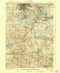
1939 Map of Jackson
USGS Topo · Published 1939About this map
The Grand River headwaters and a dense cluster of glacial lakes define this southern Michigan landscape during the 1930s. The city of Jackson dominates the northern edge, where the Michigan Central and New York Central railroads converge to serve the region's growing industrial base. South of the city, Ella Sharp Park represents a significant recreational transition between the urban center and the rural lake districts. The map reveals a pattern of mid-century settlement centered around water, including Vandercook Lake and Clarklake. Numerous small district schoolhouses like Hutchins Sch and Cullum Sch are scattered across the townships of Liberty, Napoleon, and Somerset, reflecting a decentralized rural education system still in place before the era of widespread consolidation. High points like Bunker Hill and Prospect Hill rise above the interconnected waterways of Center Lake and Wolf Lake, marking the divide between Jackson, Lenawee, and Hillsdale counties.
Find a feature on this map
80 named features on this map. Tap any name to fly to it.
Don’t see what you’re looking for? This feature index may not catch every label — zoom into the map to look around manually.
Map Details
Editions of this 1939 Jackson Map
4 editions found
Other maps of this area

1919 · Stockbridge
USGS Topo · 1:62,500

1919 · Springport
USGS Topo · 1:62,500

1919 · Rives Junction
USGS Topo · 1:62,500

1921 · Rives Junction
USGS Topo · 1:62,500

1921 · Springport
USGS Topo · 1:62,500

1922 · Stockbridge
USGS Topo · 1:62,500

1935 · Jackson
USGS Topo · 1:48,000

1939 · Jackson
USGS Topo · 1:62,500

1942 · Stockbridge
USGS Topo · 1:62,500

1948 · Spring Arbor
USGS Topo · 1:62,500