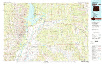
1981 Map of Jackson Lake
USGS Topo · Published 1981About this map
Grand Teton National Park dominates this 1981 survey, where the sharp rise of the Teton Range meets the valley floor. High-altitude landmarks like Mount Moran, Grand Teton, and Mount Owen overlook a network of glacial lakes including Leigh Lake and Jenny Lake. The eastern portion of the map transitions into the Teton National Forest and the Teton Wilderness, while the southern expanse covers the National Elk Refuge and the Jackson Hole Airport.
Find a feature on this map
147 named features on this map. Tap any name to fly to it.
Don’t see what you’re looking for? This feature index may not catch every label — zoom into the map to look around manually.
Map Details
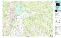
Editions of this 1981 Jackson Lake Map
2 editions found
Other maps of this area

1885 · Lake
USGS Topo · 1:125,000

1886 · Shoshone
USGS Topo · 1:125,000

1888 · Shoshone
USGS Topo · 1:125,000

1893 · Ishawooa
USGS Topo · 1:125,000

1895 · Shoshone
USGS Topo · 1:125,000

1895 · Ishawooa
USGS Topo · 1:125,000

1895 · Lake
USGS Topo · 1:125,000

1896 · Lake
USGS Topo · 1:125,000

1899 · Ishawooa
USGS Topo · 1:125,000

1899 · Grand Teton
USGS Topo · 1:125,000