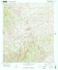
1972 Map of Jackson Mtn.
USGS Topo · Published 1975About this map
The Santa Teresa Mountains dominate this high-desert landscape at the boundary of the San Carlos Indian Reservation and the Coronado National Forest. In the early 1970s, this area of Graham County remained a remote terrain of complex drainage systems and isolated outposts. Notable family-named sites such as Hinton Ranch and Holliday Ranch are positioned near the rugged corridors of Goodwin Wash and Beauchamp Canyon. Evidence of land use is visible through several prospects and the designated Roundup Grounds, while numerous named water sources like Sycamore Spring and Fourmile Spring indicate the critical locations for ranching and travel. Peaks such as Cobre Grande Peak and Jackson Mountain provide clear landmarks for researchers tracing historic routes through this deeply dissected terrain.
Find a feature on this map
53 named features on this map. Tap any name to fly to it.
Don’t see what you’re looking for? This feature index may not catch every label — zoom into the map to look around manually.
Map Details
Editions of this 1972 Jackson Mtn. Map
2 editions found
Other maps of this area

1938 · Klondyke
USGS Topo · 1:48,000

1943 · Klondyke
USGS Topo · 1:62,500

1944 · Jackson Mtn.
USGS Topo · 1:62,500

1946 · Jackson Mtn.
USGS Topo · 1:62,500

1954 · Mesa
USGS Topo · 1:250,000

1956 · Tucson
USGS Topo · 1:250,000

1957 · Mesa
USGS Topo · 1:250,000

1958 · Mesa
USGS Topo · 1:250,000

1958 · Tucson
USGS Topo · 1:250,000

1959 · Tucson
USGS Topo · 1:250,000