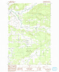
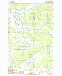
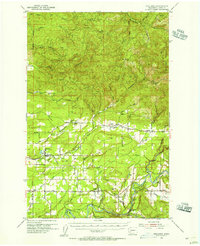
1985 Map of Jackson Prairie
USGS Topo · Published 1993About this map
Jackson Prairie and the surrounding agricultural lowlands of Lewis County define this landscape during the mid-1980s. The convergence of the North Fork, Middle Fork, and South Fork Newaukum River creates a complex drainage system that supported early settlements such as Forest and Klaus. The map highlights several preserved sites along the Jackson Highway, most notably the Jackson House, an early pioneer residence, and Matilda Jackson State Park.
Find a feature on this map
41 named features on this map. Tap any name to fly to it.
Don’t see what you’re looking for? This feature index may not catch every label — zoom into the map to look around manually.
Map Details
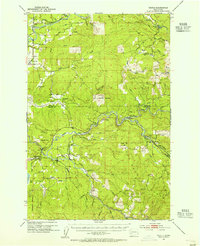
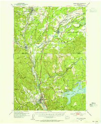
Editions of this 1985 Jackson Prairie Map
2 editions found
Other maps of this area

1916 · Chehalis
USGS Topo · 1:125,000

1941 · Olequa
USGS Topo · 1:62,500

1942 · Toutle
USGS Topo · 1:62,500

1943 · Willapa
USGS Topo · 1:62,500

1953 · Hoquiam
USGS Topo · 1:250,000
1953 · Toutle
USGS Topo · 1:62,500
1953 · Castle Rock
USGS Topo · 1:62,500
1954 · Onalaska
USGS Topo · 1:62,500
1954 · Centralia
USGS Topo · 1:62,500

1957 · Hoquiam
USGS Topo · 1:250,000