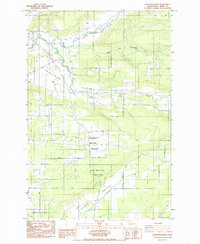
1985 Map of Jackson Prairie
USGS Topo · Published 1985About this map
Jackson Prairie and the neighboring Cowlitz Prairie define the landscape of Lewis County on this mid-1980s topographic survey. The region is characterized by a network of rural settlements and homesteads linked by family-named routes such as Koontz Road, Avery Road, and Zandecki Road. Central to the map's historical interest is the Jackson House, preserved alongside Matilda Jackson State Park, which marks an early core of development in this part of Washington.
Find a feature on this map
24 named features on this map. Tap any name to fly to it.
Don’t see what you’re looking for? This feature index may not catch every label — zoom into the map to look around manually.
Map Details
Editions of this 1985 Jackson Prairie Map
2 editions found
Other maps of this area

1916 · Chehalis
USGS Topo · 1:125,000

1941 · Olequa
USGS Topo · 1:62,500

1942 · Toutle
USGS Topo · 1:62,500

1943 · Willapa
USGS Topo · 1:62,500

1953 · Hoquiam
USGS Topo · 1:250,000

1953 · Toutle
USGS Topo · 1:62,500

1953 · Castle Rock
USGS Topo · 1:62,500

1954 · Onalaska
USGS Topo · 1:62,500

1954 · Centralia
USGS Topo · 1:62,500

1957 · Hoquiam
USGS Topo · 1:250,000