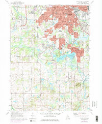
1971 Map of Jackson South
USGS Topo · Published 1978About this map
The southern reaches of Jackson and the suburban growth of Vandercook Lake dominate this landscape during a period of transition in the early 1970s. The map captures the extensive Penn Central rail infrastructure and the dense residential grid south of Michigan Ave. Large-scale public works and recreation are prominent, from the winding paths of Sparks Foundation County Park to the sprawling campus of Jackson Community College.
Find a feature on this map
100 named features on this map. Tap any name to fly to it.
Don’t see what you’re looking for? This feature index may not catch every label — zoom into the map to look around manually.
Map Details
Editions of this 1971 Jackson South Map
3 editions found
Other maps of this area

1919 · Springport
USGS Topo · 1:62,500

1919 · Rives Junction
USGS Topo · 1:62,500

1921 · Rives Junction
USGS Topo · 1:62,500

1921 · Springport
USGS Topo · 1:62,500

1935 · Jackson
USGS Topo · 1:48,000

1939 · Jackson
USGS Topo · 1:62,500

1948 · Spring Arbor
USGS Topo · 1:62,500

1949 · Spring Arbor
USGS Topo · 1:62,500

1958 · Grand Rapids
USGS Topo · 1:250,000

1961 · Grand Rapids
USGS Topo · 1:250,000