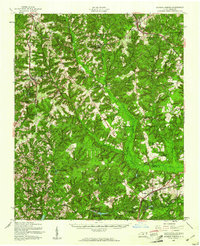
1957 Map of Jackson Springs
USGS Topo · Published 1961About this map
Camp Mackall Military Reservation occupies a significant portion of this mid-century landscape, positioned along the border of Moore and Richmond counties. The area is defined by its numerous small lakes and ponds, such as Millstone Lake, Watson Lake, and McKinney Lake, which supported local recreation at sites like Camp Millstone and Camp McLean. Transportation in the late 1950s was anchored by the Norfolk Southern and Seaboard Air Line railroads, which facilitated movement through settlements like Jackson Springs and Hoffman.
Find a feature on this map
71 named features on this map. Tap any name to fly to it.
Don’t see what you’re looking for? This feature index may not catch every label — zoom into the map to look around manually.
Map Details
Editions of this 1957 Jackson Springs Map
This is the sole edition of this map. No revisions or reprints were ever made.
Other maps of this area

1942 · Troy
USGS Topo · 1:125,000

1942 · Rockingham
USGS Topo · 1:125,000

1948 · Southern Pines
USGS Topo · 1:62,500

1948 · Pinebluff
USGS Topo · 1:24,000

1949 · Millstone Lake
USGS Topo · 1:24,000

1949 · Silver Hill
USGS Topo · 1:24,000

1949 · West End
USGS Topo · 1:24,000

1949 · Hoffman
USGS Topo · 1:24,000

1949 · Marston
USGS Topo · 1:24,000

1949 · Hamlet
USGS Topo · 1:24,000