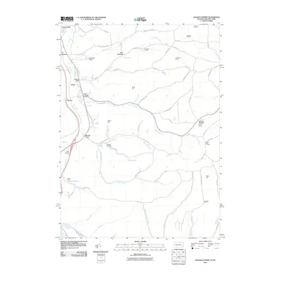
2010 Map of Jackson Summit
USGS Topo · Published 2010About this map
Lawrenceville and East Lawrence sit at the northern edge of this landscape where the Tioga River flows toward the state line. The area is defined by a network of small creeks and hollows, including Smith Creek and Buckwheat Hollow, which cut through the uplands. Further south, the Tioga Dam holds back the waters of the Tioga Reservoir, a significant modification to the drainage of Bentley Creek and Mitchell Creek. The map reveals a dispersed settlement pattern typical of the rural borderlands, with clusters at Jackson Summit and Tioga Junction. Local history is preserved in numerous family and community burial grounds, such as Dickenson Cemetery and Maple Ridge Cemetery, which are scattered among the ridges like Gobblers Knob and Tower Hill. The transition from river valley to high ground is traced by old routes like Mutton Lane Creek and the path of the Tioga River Rd.
Find a feature on this map
71 named features on this map. Tap any name to fly to it.
Don’t see what you’re looking for? This feature index may not catch every label — zoom into the map to look around manually.
Map Details
Editions of this 2010 Jackson Summit Map
This is the sole edition of this map. No revisions or reprints were ever made.
Other maps of this area

1895 · Elmira
USGS Topo · 1:62,500

1900 · Tioga
USGS Topo · 1:62,500

1902 · Tioga
USGS Topo · 1:62,500

1905 · Watkins Glen
USGS Topo · 1:125,000

1914 · Corning
USGS Topo · 1:62,500

1931 · Troy
USGS Topo · 1:48,000

1938 · Troy
USGS Topo · 1:62,500

1944 · Corning
USGS Topo · 1:62,500

1950 · Elmira
USGS Topo · 1:250,000

1953 · Roseville
USGS Topo · 1:24,000
Featured Places
- Lindley, NY
- Jackson Township, PA
- Tioga Township, PA
- Lawrence Township, PA
- Tioga Junction, Lawrence Township