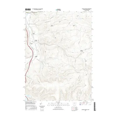
2016 Map of Jackson Summit
USGS Topo · Published 2016About this map
The Tioga River corridor defines the western edge of this landscape, where the borough of Lawrenceville sits at the Pennsylvania-New York border. This modern digital survey documents the topographical complexities of the Northern Tier, where narrow valleys like Buckwheat Hollow and Barber Hollow cut through high plateaus. The map is particularly valuable for genealogical research, identifying numerous family-associated burial sites including Middaugh Cem, Dickenson Cem, and Morrell Cem. The southern reach of the sheet is dominated by the Tioga Reservoir, a significant flood-control feature that has reshaped the local drainage of Mitchell Cr and Mill Creek. Transport patterns are visible through established settlements like Tioga Junction and Jackson Summit, connected by a network of rural routes such as E Lawrence Rd and Skyline Dr.
Find a feature on this map
79 named features on this map. Tap any name to fly to it.
Don’t see what you’re looking for? This feature index may not catch every label — zoom into the map to look around manually.
Map Details
Editions of this 2016 Jackson Summit Map
This is the sole edition of this map. No revisions or reprints were ever made.
Other maps of this area

1895 · Elmira
USGS Topo · 1:62,500

1900 · Tioga
USGS Topo · 1:62,500

1902 · Tioga
USGS Topo · 1:62,500

1905 · Watkins Glen
USGS Topo · 1:125,000

1914 · Corning
USGS Topo · 1:62,500

1931 · Troy
USGS Topo · 1:48,000

1938 · Troy
USGS Topo · 1:62,500

1944 · Corning
USGS Topo · 1:62,500

1950 · Elmira
USGS Topo · 1:250,000

1953 · Roseville
USGS Topo · 1:24,000
Featured Places
- Lindley, NY
- Jackson Township, PA
- Tioga Township, PA
- Lawrence Township, PA
- Tioga Junction, Lawrence Township